Road Cross Section and Quantity CalculationRoad Estimatorâ„¢Road Estimatorâ„¢

Quantity surveying software for road cross section generation and quantity calculation of road works.
Road Estimation

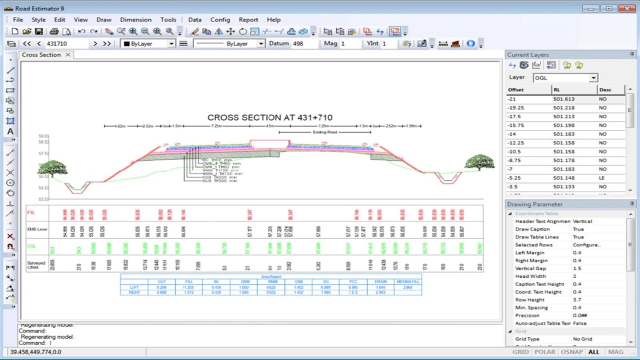
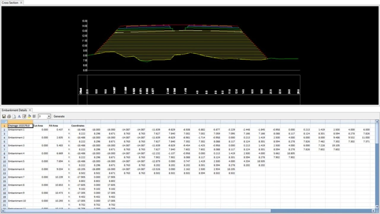
Road Estimator is the most trusted road quantity calculation software that gives road contractors  and other stakeholders a unique edge to effectively estimate for road construction. It is complete software for road cross-section and quantity calculation of new roads and upgrade cases where widening & strengthening of existing roads have to be undertaken. Whether it is expressways, national highways, urban, village or any kind of roads, design or site-level alterations can be incorporated quickly without time overruns. Quantity surveying software for road construction cost calculator  and quantity estimation.

Single-lane or multi-lane with or without service roads and pavement consisting of sub-base layer, base layers & surface layer without any limitation on a number of layers or materials.

While improving the safety of roads for increased vehicular traffic, technical challenges involved in road widening & repairing can be easily accommodated in Road Estimator for quantification, be it soil replacement, change in cross slopes or super-elevation or introduction of new pavement layers and drains.

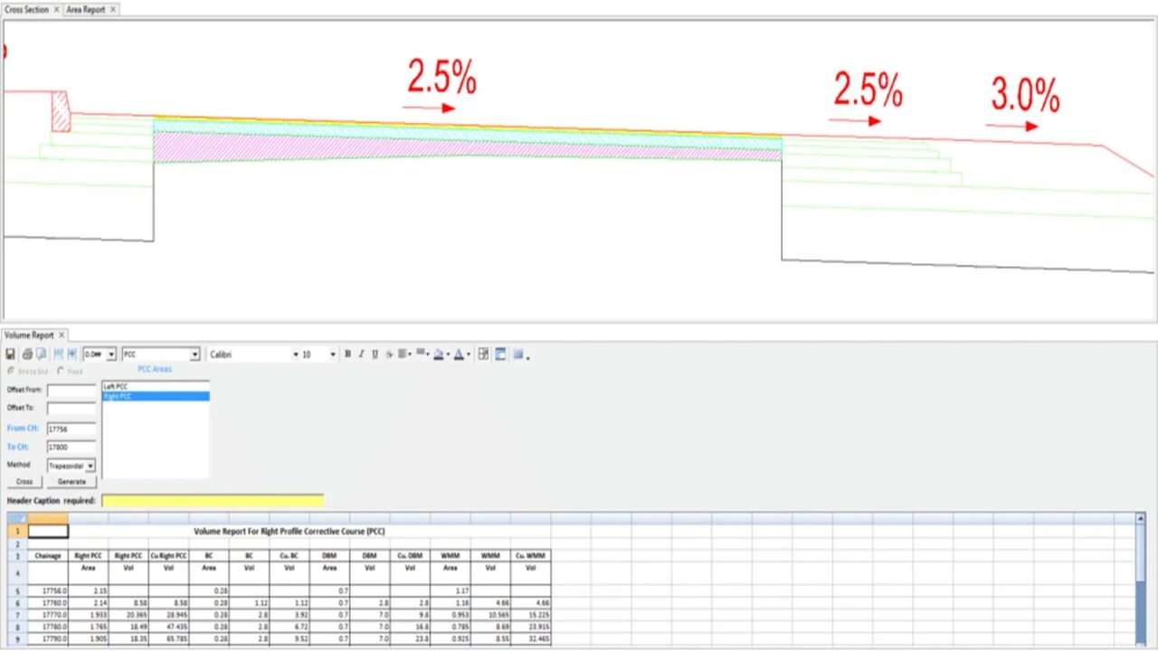
Road Estimator, one of the best road work estimate software, automatically detects various road overlay conditions to calculate profile corrective courses for strengthening an existing road.

New Roads
Widening of Roads
Strengthening of Roads

Top Reasons to choose Road EstimatorReasons

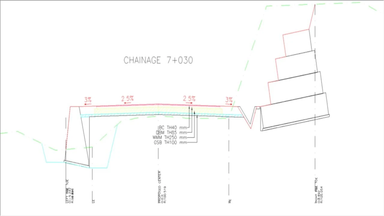
road cross section drawing
road estimator
road quantity calculation software
Automatic PCC Calculation
Different types of Road Elements
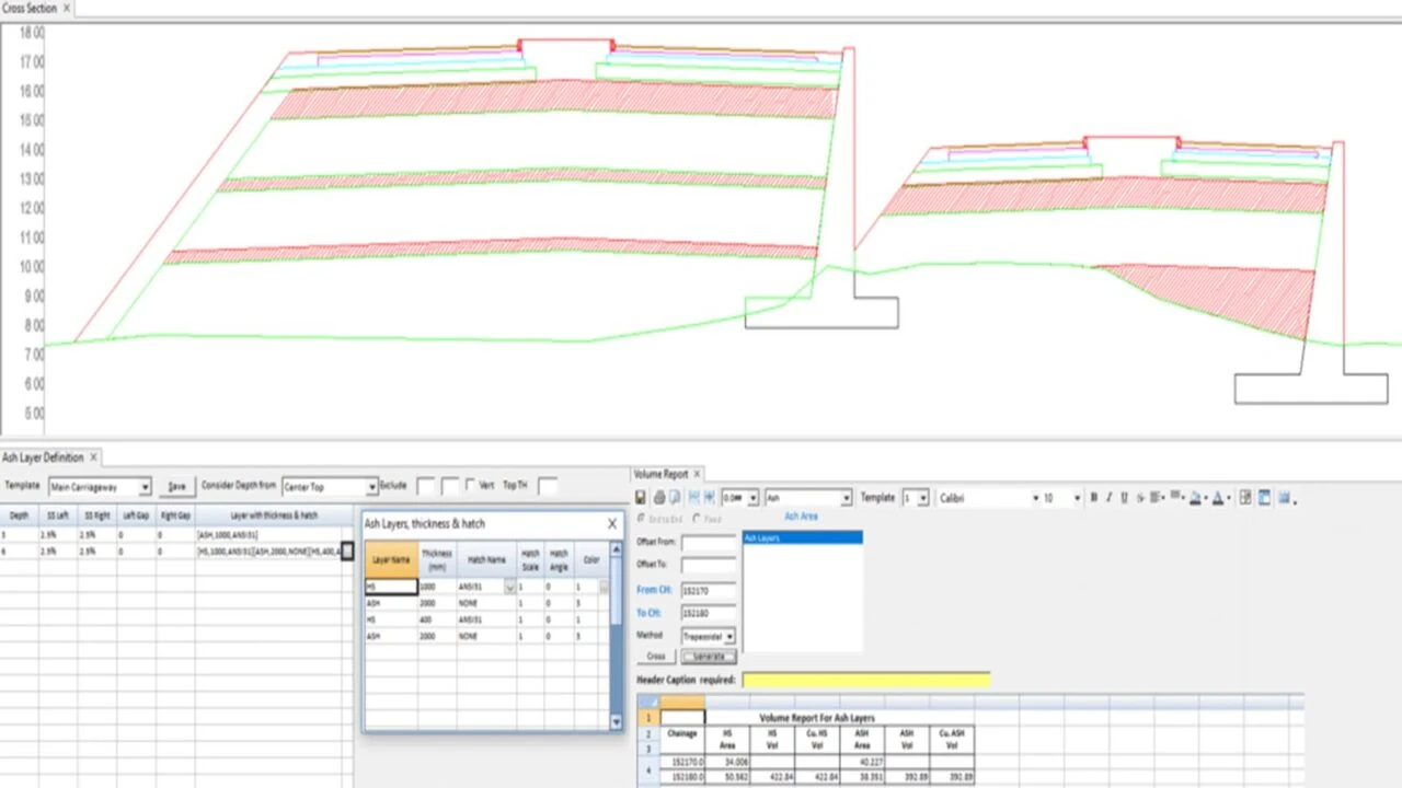
Ash layers In Road Estimator
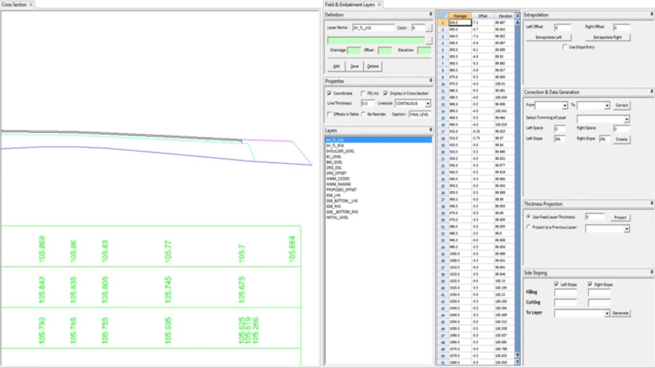
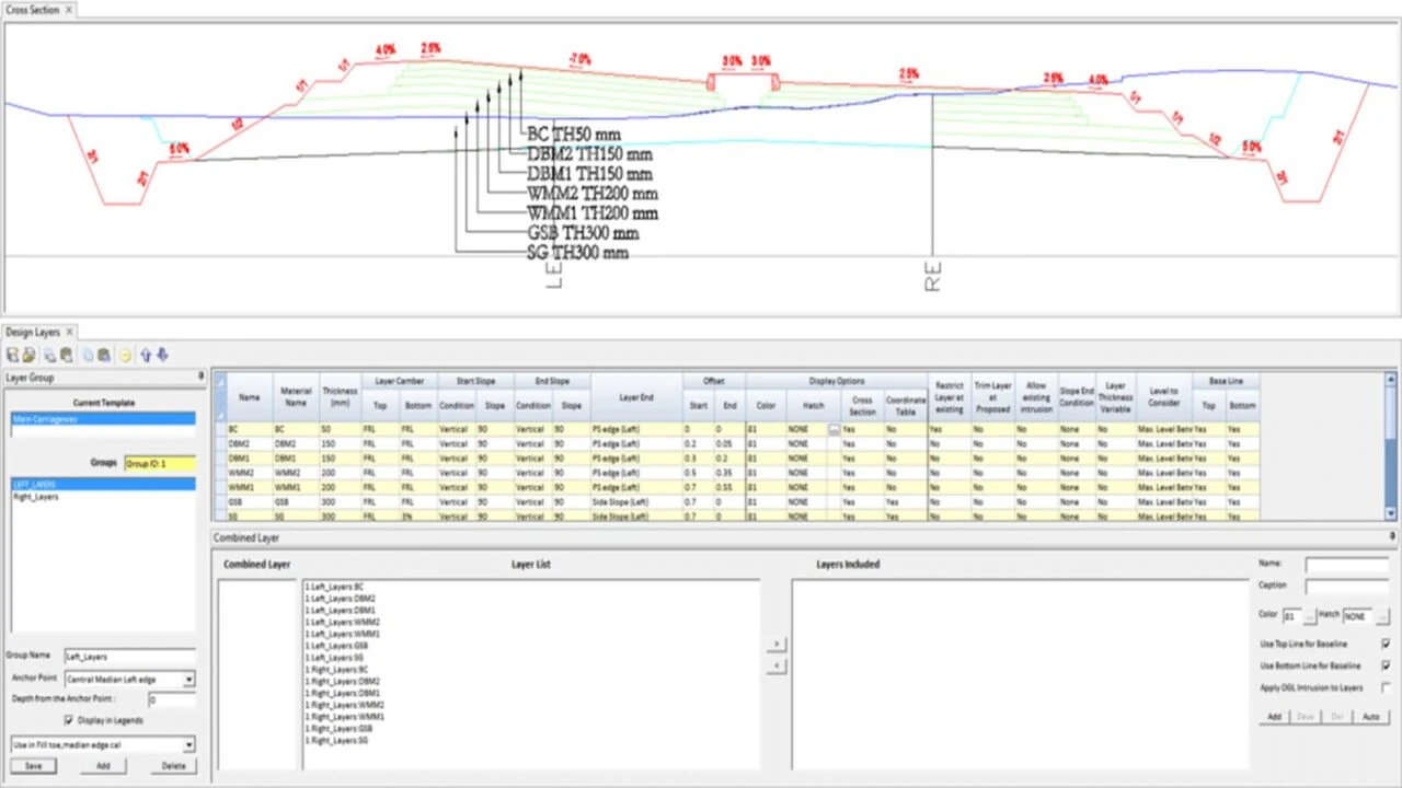
Design layers
fast-and-accurate-reporting.jpg
Automatic Layer detection

CapabilitiesRoad Estimator

User friendly CAD Interface
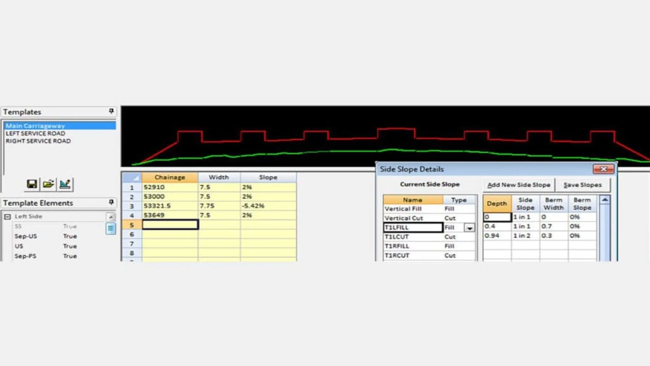
Template based Solution
As-Built Drawing Generation
Automatic PCC Calculation
Supports Different Types of Road Element
Ash Layers
Easy Design Layers Definition
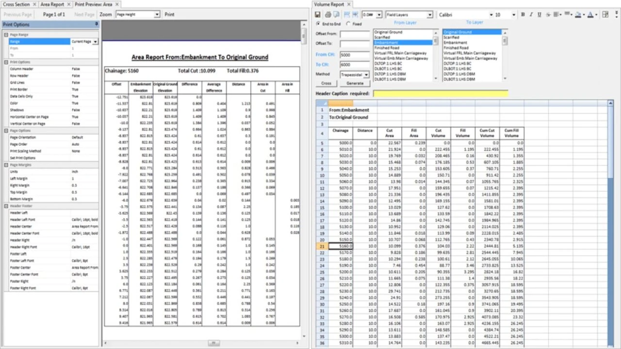
Fast & Accurate Reporting
Automatic Embankment Layer Detection
Faster Data Processing

Road Estimator Training - 66% OFF*Exclusive

Learn and explore more about Road Estimator at your pace and preferred time. Get certified upon completion - Welcome to hassle free learning!
Limited time early bird offer*
On-demand Webinar

Road Estimator Webinar Series is LIVE!

Learn more about Road Estimator, such as road cross section creation, Widening & Strengthening, Railway cross sections and Main Carriageway with Service Roads.

Why is Road Estimator the best software for Road Construction?

Infycons Road Estimator, the leading road quantity calculation software, helps in accurate calculation of the various materials including pavement layers, cutting and filling, profile correction etc. It is one of the easiest software available in the industry for cross section generation that anyone with Civil and Transportation Engineering background will be able to learn in the shortest duration of time. Its complete set of tools integrated with built-in CAD provides users full control to work on any type of roads.
News and announcements

Road Estimator latest

Quantity takeoff of varying road construction Layers
Road construction layers are a complex and challenging aspect for various stakeholders involved in road construction, including engineers, contractors, and quantity surveyors. One of the major challenges in road construction is the frequent changes in the cross-profile and pavement layers of the road. as per the design and site conditions. The cross-profile refers to the...
Read more
Filter Media Definition for Retaining Wall in Road Construction
Topographic map creation in AutoPlotter is a useful feature for the land surveyors that eases the topo drawing creation from the survey data captured from any make of total station or GPS. Maps can be generated automatically from the data having Northing, Easting, Elevation and reference code.
Read more
Longitudinal Section (L Section of Road) and Cross Section of Road
GIS mapping works on collecting the data based on the relationship between the two points tied geospatially. The GIS mapping provides colour coded maps for different criterias as layers so that the geographers, land surveyors and mining engineers can be able to toggle between the layers to find elements of the maps like the existent landscape, underground electrical lines, underground pipe system or the water level by defining the contour of the place.
Read more
Road Estimator – Hill Road Estimation
To achieve optimum design where road alignment is attained as per design standards and without excessive costs, it is necessary for the road designer to choose cross sectional elements wisely that helps to accomplish the final geometric design requirements.
Read more
Road Estimator – Widening & Strengthening of Roads
Strengthening of existing road is carried out to increase the stability of road to meet the increased demand in traffic or other criteria. Procedure wise, the existing road should be corrected first with the profile corrective course (PCC) followed by the surface layers.
Read more
Road Estimator – Get final output in direct printable format
When it comes to report generation, complete area, volume or length reports are to be generated as per requirement. To understand, cutting & filling area of a cross section can be generated in full for the entire cross section. But if the construction is planned only for one side, area should be generated only for that portion.
Read more
road cross section
Road Estimator – Easiest software for cross-section and quantity calculation
Road Estimator (RE) has proved to be an important software tool to automate the entire process of quantity takeoff. Working stage cross sections and quantities can be estimated using the design data such as the finished road levels, pavement layer details, super-elevation etc.
Read more
Median or Footpath (Sidewalk) Kerb
While defining template in Road Estimator, kerb can be inserted by selecting the required one from the list displayed. The point of insertion can be median, carriageway, paved shoulder, earthen shoulder edge on either left side or on the right side of the road.
Read more
Road estimator software
Introduction to Road Estimator
It requires a great effort to complete road construction project successfully. While all the stakeholders have crucial roles to play, quantity surveyor’s responsibility in replicating the actual site conditions to get the accurate estimate or as-built quantities is equally important.
Read more

People about Road EstimatorWhat are our
clients sayingClients

Quick Adaptability!

Capabilities of Road Estimator to meet different types of construction conditions for road cross section and reports generation has encouraged us to adopt it for our road projects. We are a very long time user and appreciate their team for very good support too. Highly recommended.

Neeraj Kumar
GR Infraprojects Limited

Exceeds Expectation

Initially we were skeptical whether Road Estimator would be fine for us because we are working on a railway project in Bangladesh and requirements are different than highways. We were taken by surprise, now our team is convinced and the same is getting used at our other sites apart from road projects.

Nivedan Iqbal
Afcons Infrastructure Limited

ab
indian oil
lnt
jsw
reliance
TATA
unitech
gayatri
acc
essar

FAQ's

Can we use Road Estimator for railway project?

Yes, it is possible and is being used in many railway projects.

Which method is used for volume calculation in Road Estimator?

Volume can be calculated using Trapezoidal / Simpson’s rule.

Is it possible to import total station data (XYZ) in Road Estimator?

No, AutoPlotter with Road Estimator is required in such cases.

Can we generate 6 lane road sections?

Yes, it is possible to define number of lanes/roads/service roads as required.

What is the system requirement?

Supported OS: Windows 10 and above
Minimum RAM: 1 GB
Minimum Space: 2 GB

Do you offer training in the use of Road Estimator software?

Yes, we do offer training in the use of Road Estimator – MasterClass.

How can I purchase Road Estimator Software?

Kindly fill in the purchase/order request form available on this website so that we can get in touch with you. You can also give us a call at +91 80 66320710 or email us at sales@test.infycons.com.

What kind of estimations can be done using the road estimator software?

Road estimator software helps to generate cross sections and the materials that needs to be used in construction of any types of roads and railways.

Bengaluru
F-2104, 1st Floor, Tower B, Ardent Office One, Hoodi, Bangalore 560048, Karnataka, India.
Email us
sales@test.infycons.com
Give us a call
+91 80 66320710
Are you an existing user ?

Road Estimator InfyCare Web Subscription

Road Estimator InfyCare Web Subscription includes a wide of features to help you understand the product better and increase your ROI. The subscription comes along with your product AMC and offers: Quick Start Guide, On-Demand Tutorials, Latest Software Updates, One-to-one Trainings*, Consultations*, Feature Request, Priority Support, Refer and Earn^.

Contact Us